
Localization and means of access.
Geographical position
Mar del Plata is the head city of the General Pueyrredón district and it is on the Argentine Sea on the SE of the Buenos Aires Province, Argentine Republic.With the following coordinates: 38º00’ South latitude, 57º33’West longitude (San Martin Square).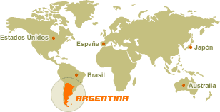
Situation and geographical localization.
Its situation in relation with the main cities of the different Mercosur countries, Chile and
Bolivia , lets us determine a priori that it is potentially a city of international business and traffic as much through terrestrial, maritime and air means. Its distance to the main Spanish speaking population, consumer and production centre of the South Cone- Buenos Aires and Greater Buenos Aires- makes Mar del Plata a growing pole of potential importance for the Argentine Republic.
Means of communication.
It has three provincial main roads and a highway which communicates with the Federal Capital, a railway station with 29 services weekly, a bus station in which more than 50 companies sell their tickets, an airport of international alternative in which 6 aeronautical companies operate with more than 130 weekly services and an artificial deep water port which, besides being fundamental for the fishing activity, allows in its north breakwater to anchor the excursion boats .
Locality area.
1.453,44 km2 (density 366,5 inh/km2).
Urban common land area of the city .
79,48 km2(7.948 he.)
Geographical centre of the urban common land.
Avellaneda between Misiones and Italia streets.
Locality limits.
NE: Mar Chiquita Locality.
SW: General Alvarado Locality.
SE: Argentine Sea.
NW: Balcarce Locality.
More date in www.mdp.com.ar


